
Bomoseen Map
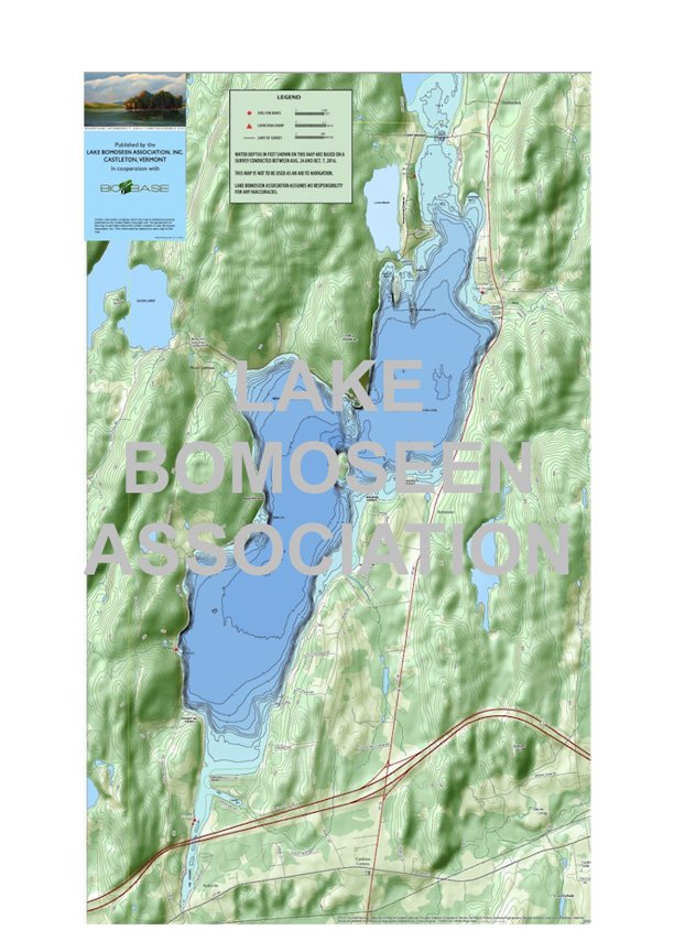
The Association’s Map of Lake Bomoseen © is a bathymetric presentation of the lake bed topography, a very interesting view of how the glacier created us. The lake bed depth contours around Rabbit Island, Black Rock and Neshobe Island, and the Cooksville Bay and Reed Point locations on the west shore are especially dramatic.
The map was generated by two LBA Directors, Bill Wood and Terry Moran, who crisscrossed the lake (a 100 mile journey) in the summer of 2016 with specialized sonar equipment and mapping software.
The survey’s primary objectives - exactly where on the Lake the milfoil infestation concentrations are and the makeup of the Lake bottom that determines where milfoil will grow - were achieved, and the Association uses that data today in our Harvesting Program.
We will mail this through US Mail or you can pick it up locally. Please email LBA Treasurer John Hale (john@sudokuvt.com) to arrange pick up.
Additional donations are welcome; to make an additional donation in this transaction, add a “donation” to your cart before checking out.